Showing posts with label Wales. Show all posts

Wednesday, January 31, 2018

The history of middle-class wine drinking


History Extra


Should politicians tell people what and how much to drink? Recent government decisions to try and impose a minimum price for alcohol sales in England and Wales have taken the campaign against what is seen as excessive consumption into intriguing new territory. (Scotland and Northern Ireland have been having their own debates about how far the law can intervene). The focus now is not only on places where people go out to drink but also on domestic consumption. And middle-class consumption of wine is receiving much more attention too.

Ironically it has been attempts to increase rather than decrease wine consumption in Britain that have figured more prominently in the past – at least since the 19th century. Prior to that, wine, as the imported tipple of the mainly well-to-do, had seen some regulation and had at times been caught up in trade disputes, especially with France. Increased duties were imposed on imported French wine to try and harm French commerce. Spanish and Portuguese wines, by contrast, were generally favoured as these countries were more consistently allies of Britain.

But by the mid-19th century, British champions of free trade challenged such use of tariffs as diplomatic weapons. Good trade relations – sealed amicably, no doubt, over bottles of good vintage – helped prevent future wars, it was argued.

James Nicholls of Bath Spa University, a specialist on the history of alcohol consumption, hails the 1860 Treaty of Commerce – in which import duties were reduced on all wine – as a turning point. William Gladstone, the treaty’s chief architect, spoke openly of what he hoped would be a change in British drinking habits – away from an obsession with beer – so that wine would no longer be a “rich man’s luxury”.

At the same time he was sensitive to the fears of Victorian temperance campaigners that cheaper wine would encourage drunkenness. More wine drinking was meant to civilise British drinkers, claimed Gladstone. His measures were intended for the “promotion of temperance and sobriety as opposed to drunken and demoralised habits”. Other changes – forerunners of the modern ‘off licence’ system – allowed grocers and restaurateurs, rather than just pubs, to sell alcohol. They were intended to weaken the “unnatural divorce between eating and drinking”.

 Behind all this lay cultural assumptions about alcohol consumption that always lurk in these debates. We have tended, says James Nicholls, to “imbue different drinks with different ethical values”. Whereas some have been linked to the bad habits of the lower orders – think of Hogarth’s image of social catastrophe in Gin Lane, or modern debates about lager louts – wine was never associated with boorish drunkenness in this way.

Though there was an initial increase in wine drinking (what’s been called ‘the era of cheap Gladstone claret’), British cafĂ© society, combining wine-drinking with eating, never took off as Gladstone might have hoped. It was only in the 1960s that there was, as Nicholls puts it, a “greater democratisation of wine drinking”. More wines became available from around the world, and supermarkets added competition. As a result, wine sales have steadily increased, while beer consumption has declined.

So Gladstone might have been pleased by today’s spread of wine into British drinking culture. It is no longer the reserve of the rich. But he would have worried about the evidence that consumption – for some individuals – is rising rapidly. Health professionals, today’s equivalent of 19th‑century temperance campaigners, no longer seem to share the old assumption that wine-drinking is inherently less harmful than other kinds of alcohol.

Extra But reversing this trend will not be easy. Policing what goes on in pubs has been far easier than controlling what people do in their own homes. The long contest between political and moral control and Britain’s ‘drinking culture’ is entering a fascinating new phase.

Chris Bowlby is a presenter on BBC radio, specialising in history

This series is produced with History & Policy.

Friday, September 8, 2017

The 4 Kingdoms that Dominated Early Medieval England


Made from History


This map shows how Britain was diveded up between the Anglo-Saxon kingdoms in the Middle Ages
BY CRAIG BESSELL

 In the wake of Rome’s withdrawal from Britain in 408 AD the political situation was unstable, no one really had a claim to any particular piece of land. Therefore the person with the biggest army, or more accurately, the largest group of fighting men was able to hold the bigger, more desirable pieces of land. Eventually though some semblance of a political structure grew and boundaries were drawn. 

By 650 AD a sporadic patchwork of small kingdoms had been established by strong chieftains who at this point had taken to calling themselves kings of their respective micro-kingdoms. These kingdoms were Bernicia, Deira, Lindsey, East Anglia, Mercia, Wessex and Kent. In time the smaller or less successful kingdoms were absorbed into the others, either through aggression, economic shift or by marriage until a simpler system was revealed. By the eighth century four kingdoms remained, Northumbria, Mercia, East Anglia and Wessex.

 1. Northumbria
Northumbria was a region that stretched across the neck of northern England and covered much of the east coast and parts of southern Scotland. Modern York was at its southernmost border and Edinburgh at its north. It was formed in the seventh century upon the unification of Bernicia and Deira, the northern and southern parts of the kingdom, respectively. The kingdom was traditionally at odds with Mercia, their neighbouring kingdom. Both consistently raided each others lands and sometimes launched full scale invasions in an attempt to subdue one another.

 2. Mercia
Mercia was a large kingdom that covered most of middle England. Its fortunes fluctuated as it was bordered on all sides by potentially hostile rivals. To its north, Northumbria, its west the Welsh kingdoms, traditional enemies of all Anglo-Saxons, to its east, East Anglia and to its south, the least aggressive of its neighbours, Wessex. It was often at war, mainly with Northumbria and Wales, but maintained a largely harmonious relationship with Wessex.

 3. Wessex
Wessex was an unstable, but fertile country that covered most of the south west. It was bordered by the Celtic kingdoms of Cornwall to its west, Mercia to its North and Kent to the East. As was the mode of the period Wessex was constantly at odds with its neighbours and actually dwindled as Mercia began to take some its lands before King Egbert rose to power in the 8th century. Its economy and strength grew under Egbert with the acquisition of Surrey, Sussex, Kent and Essex. He took these lands, abolished the kingdom of Kent and established overlord-ship over Mercia and Northumbria. During his reign he established Wessex as the strongest, wealthiest, most civilised of all of the Anglo-Saxon kingdoms.


In this map of 8th century Britain you can see the formerly independent states of Kent, Essex and Sussex incorporated into the larger Kingdom of Wessex

 4. East-Anglia
 East Anglia was the smallest of the Anglo-Saxon kingdoms, but powerful during the reign of the Wuffingas dynasty. However, by the end of the eighth century it had been subdued by the more powerful Mercia and fell under their rule. East-Anglia briefly claimed independence back in the ninth century before being swiftly conquered and settled by Danish Vikings.

 These kingdoms survived for many years, though their borders were often subject to change. Towards the end of the ninth century the whole of Anglo-Saxon Britain faced immense upheaval in the form of invaders from the north, the Vikings. Their invasion would set in motion a series of remarkable events that would bring an end to the separate Anglo-Saxon kingdoms and bring forth one single united Angle-Land.

Monday, July 3, 2017

Multiple Previously Unknown Prehistoric Burial Sites Detected Around Bryn Celli Ddu


Ancient Origins


A team of archaeologists has conducted a geophysical survey that has revealed what appears to be a cairn cemetery at the prehistoric ritual area around Bryn Celli Ddu on the Welsh island of Anglesey. This previously unknown manmade landscape could be connected to an even larger complex in the surrounding area in what experts have described as “really exciting stuff.”

 Tomb Way Bigger than the Experts Originally Thought
Bryn Celli Ddu, a prehistoric site on the Welsh island of Anglesey that its name means “the mound in the dark grove,” apparently hides more secrets about its past than experts originally thought. Archaeologists have recently detected a prehistoric ritual landscape that may include a cairn cemetery around a 5,000-year-old tomb. Interestingly, archaeologists found out that the tomb, which had been used for thousands of years, was actually way bigger than they initially believed, while on the longest day of the year a beam of sunshine invades in through its main passage, illuminating the entire chamber as Wales Online reports.


Bryn Celli Ddu Passage Tomb is a Neolithic site that overlays an earlier henge monument. (CC BY SA 2.0)

 The Legacy of Bryn Celli Ddu
Despite not being as popular as Stonehenge, undoubtedly the most iconic prehistoric monument in the UK, Bryn Celli Ddu is one of Wales’ most impressive and significant ancient historical sites. As Dhwty reports in a previous Ancient Origins article, Bryn Celli Ddu was not only a stone circle, but also operated as a ‘”passage tomb” and was a place to pay tribute to, and protect the remains of ancestors. Archaeologists have suggested that the original stone circles were set up during the Neolithic period, around 3000 BC and it is speculated that during the time of its construction, it was located in a large clearing surrounded entirely by a forest. An outer circular bank and an inner ditch encircled the area, which was originally 21 meters (69 feet) in diameter, and defined the parameters of the monument.


Stone layout of the passage burial mound with timeline. (Youtube Screenshot)

According to archaeologists, the function of Bryn Celli Ddu changed towards the end of the Neolithic, around a thousand years after it was built. Bryn Celli Ddu became a passage tomb, a type of burial monument found around the Irish coastline and some of the standing stones were deliberately destroyed, while a mound was built over the ritual enclosure. Within the mound was a polygonal stone chamber that was reached via an 8 meter (26 foot) long passageway. In 1865 Bryn Celli Ddu was first explored seriously, though it was only in 1928 that a thorough excavation was conducted at the site. At the end of the excavation in 1929, some of the structures were repositioned.

Passageway into Bryn Celli Ddu. The passage opens out to a bigger central chamber. (CC BY SA 2.0)

Researchers Use 3-D Technology and Detect Multiple Cairns
Experts used 3D digital modeling at the Neolithic passage tomb for the first time in order to learn more about its past and usage. According to the re-examination, it now seems that at Bryn Celli Ddu was a large cairn complex or cairn cemetery. As Wales Online explains, a cairn is a man-made pile of stones which is usually used to mark a burial site. Dr. Ben Edwards, from Manchester Metropolitan, that has been investigating the site recently, told Wales Online, “We hit the fields with different geophysical techniques and we found at least four burial cairns. We originally thought it was lone monument but now we know there are four. It seems a complex developed over many years. We call it a cairn cemetery. It is from the Neolithic through to early Bronze age.”


Sketch map showing multiple cairns plus rock art local to Bryn Calli Ddu (Youtube Screenshot)

Apparently, the site has seen human activity for many thousands of years and with several examples of rock art identified as well. Dr. Seren Griffiths, from the University of Central Lancashire, verified the existence of humans at the site by telling Wales Online, “We know that Bryn Celli Ddu sits in a much more complicated landscape than previously thought. Over the last three years, we have discovered 10 new rock art panels and this year the picture has developed to include further evidence for a new Bronze Age cairn along with a cluster of prehistoric pits. We have evidence for over 5,000 years’ worth of human activity in the landscape, ranging from worked flint derived from the tool-making efforts of our prehistoric ancestors to prehistoric burial cairns and pits with pottery deposited within.”


Carved stone from Bryn Celli Ddu tomb, Anglesey. National Museum of Wales (CC BY-SA 3.0)

Impressive Colors and Irish Influence
Dr. Edwards was impressed with both the rock art and the incredible blue color of it, “We don’t dig the monument itself but have investigated the landscape. We have looked at the rock art. This is an incredible blue color but also has colors like gold and fool’s gold. We found that about 10 more rock outcrops with this carved art. Unless you know what you are looking for they are hard to spot,” he told Wales Online. He also added that another interesting thing about the newly found tomb is that it doesn’t look like your typical British monument, “It is much more like what you find in Ireland and this was not coincidence. They were communicating around the Irish Sea,” he said pointing out the obvious Irish influence at the site.


Ultimately, Dr. Ffion Reynolds, from Cadw, couldn’t hide his excitement about the project’s outcome as Daily Post reports, “Since we started the project we have discovered that Bryn Celli Ddu was never in isolation, there was activity happening all around. We knew this would be a good project but it’s turning out to be very exciting.”

Top image: The 5000-year-old burial chamber at Bryn Celli Ddu on Anglesey (CC BY-NC-ND 2.0)

By Theodoros Karasavvas

Tuesday, May 9, 2017

Why were they called the Tudors?

History Extra


 The Tudors were originally from Wales, but they were not exactly of royal stock. The dynasty began with a rather scandalous secret marriage between a royal attendant, named Owain ap Maredydd ap Tudur, and the dowager queen Catherine of Valois, widow of King Henry V.

 Surprisingly, the two were allowed to remain married, and their children were recognised as legitimate. But it would be two of their sons, Edmund and Jasper Tudor, who would rise at court, recognised as half brothers to Henry VI.

 It was also Edmund’s son by his wife, Margaret Beaufort, Henry Tudor, who emerged as a strong claimant for the throne through his mother, a descendent of Edward III.

 Lauren Mackay is the author of Inside the Tudor Court: Henry VIII and his Six Wives through the Life and Writings of the Spanish Ambassador, Eustace Chapuys (Amberley Publishing).

Tuesday, January 10, 2017

Archaeology Graduate Discovered Lost City of Trellech After Using Life Savings to Buy Field

Ancient Origins


The tale of how an amateur archaeologist’s hunch led him to uncover a lost medieval town and spend £32,000 of his own money to buy the land, would stand to be the archaeological discovery of any year. On the border between England and Wales, the site of the medieval town of Trellech reveals much about a tumultuous period of history – and how the town came to be lost.

The story begins in 2004, when archaeology graduate Stuart Wilson began his search for this lost medieval town in Monmouthshire, south-east Wales, near where now only a small village bears the name. In the face of scepticism from academic archaeologists, Wilson’s years of work have been vindicated with the discovery of a moated manor house, a round stone tower, ancillary buildings, and a wealth of smaller finds including pottery from the 1200s.


How the manor house at Trellech might have looked, judging by the discovered remains. Paul Davies

The town could turn out to be one of the largest in medieval Wales, and while there is more work to be done, the evidence is building. The large number of finds – including metalwork, cooking vessels and decorated pottery – point to a large settlement, and are essential in helping archaeologists date the site. What they suggest is a short-lived but intensive period of occupation between the 12th and early 15th centuries, during which the town was founded by the De Clare family as an industrial centre and later destroyed during the Owain Glyndwr rebellion in 1400. This was a period of instability on the Welsh border, with conflict between rival Welsh princes and the English throne. Settlements like Trellech would become the focus of such clashes, culminating in Glyndwr’s rebellion.


Alongside a road, under the ground a medieval manor lies waiting. ender4000/Lost City of Trellech

Ever-disappearing archaeology
What makes the lost city of Trellech so important is its rarity and the quality of its preservation. Most large medieval settlements in England and Wales are still towns and cities to this day. This means archaeological investigations of medieval London or York for example are difficult and expensive, and can only occur piecemeal as urban redevelopment allows excavation of small areas. If Trellech turns out to be an extensive town, it will be a unique and important site. As archaeology is key to understanding the lives of everyday people who are ignored by the histories of the great and the good, sites like Trellech are the only way we gain these insights.

It may seem surprising that an entire medieval town could become lost from the historical record for more than 500 years, but in fact this is more common than you might think. Medieval Britain was characterised by poor documentary records, particularly outside major centres of political or religious power like London, Edinburgh, York or Canterbury. A settlement could be destroyed, fall into decline, or be abandoned – and if no written records existed or those that did were subsequently lost, it’s quite possible for there to be no account of its existence.


A well discovered in the Medieval city of Trellech. Credit: Stuart Wilson

At the very least, the precise location of a settlement can be hard to trace as over time land is reclaimed as farmland, or stonework that might otherwise last is removed for buildings elsewhere. Wooden structures decay within decades. Sites on flood plains can be covered by metres of alluvial (fertile clay, silt and sand) deposits, while upland settlements may be reforested. And in modern times, mechanical ploughing has been extremely destructive to the archaeological record. Due to any or all of these natural processes, finding a lost site requires dedication and concerted archaeological research, or a chance find.

Given the many things that could have damaged medieval Trellech’s remains beyond recognition, it is incredibly significant that it survives in such good condition. The longer back into the past we look, the more common it is to lose settlements, buildings or monuments – particularly into prehistory, before documentary evidence. Trellech is proof that any field in the UK could conceal an important site, and this is precisely why professional archaeological investigation before building work is essential.

One man’s dedication
Trellech’s discovery is also important due to how it was found. Most important discoveries in Britain are uncovered by professional archaeologists undertaking paid work, and the number of these discoveries easily dwarf the work done by university researchers. But in this case, Trellech was revealed through the commitment and perhaps bloody-mindedness of one man and a dedicated team of volunteer archaeologists.

 British archaeology as a discipline and profession grew out of exactly this kind of work: in the 19th and early 20th centuries fresh archaeological ground was broken by the likes of Nancy Newbigin, John Mortimer and Canon William Greenwell, all working as unpaid, self-taught experts in what was then a new field of learning.

So in this sense, Wilson and his team belong at the heart of one of the great traditions of archaeological research: all over the country local societies and archaeological associations work tirelessly in the same way to uncover neglected corners of Britain’s past. Long may they continue.

Top image: Foundations of Round Tower at Trellech. Credit: Stuart Wilson

This article, originally titled ‘The discovery of medieval Trellech and the plucky amateurs of archaeology’ by Ben Edwards was published on The Conversation and has been republished under a Creative Commons license.

Monday, January 9, 2017

Bleddyn ap Cynfyn: the first Prince of Wales?

History Extra


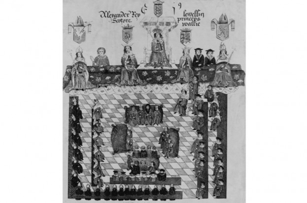
Many of us will have heard of Llewelyn the Last, seated to the right of Edward I in this picture. But who was the first Prince of Wales? (Hulton-Deutsch Collection/CORBIS/Corbis via Getty Images)

As highlighted by the recent 950th anniversary of the Norman conquest of England, in 1066 there was much more going on in Britain than a simple clash between King Harold’s Anglo-Saxons and Duke William’s Normans. As a Welsh historian, it is hard not to conclude that many of the crucial pieces of the jigsaw remain left out of the picture of that epochal year. The third quarter of the 11th century was arguably one of the most formative and dramatic in the entire history of Wales, with events west of the rivers Severn and Dee impacting enormously on those in England and beyond. When the Normans arrived on the Welsh border they would be met by a leader who, I would argue, can be called the first prince of Wales – Bleddyn ap Cynfyn. Yet despite being one of Wales’s greatest leaders, Bleddyn has until now been all but forgotten.

 The years before Bleddyn’s accession in 1063 had seen Wales rise to an unprecedented position of power and unity, all achieved under the direction of one man: Bleddyn’s half-brother, Gruffudd ap Llywelyn – the first, last and only king of all the lands of modern-day Wales. His story also remains little known, even in his own country; the BBC’s 2012 Story of Wales TV series managed to leap straight from 950 to 1066, entirely missing the reign of the country’s greatest ruler.

 A united Wales
Gruffudd united all the territories that comprise modern Wales, conquered land across the border that had been in English hands for centuries, forged alliances with key Anglo-Saxon dynasties and even turned the Viking threat to his realm into a powerful weapon. In 1055, Gruffudd led a great army and fleet against the English border, crushing its defenders, burning Hereford and forcing Edward the Confessor to recognise his status as an sub-king within the British Isles. Having emerged as a war leader, Gruffudd would also prove to be a patron of the arts and the church. He had all the trappings of a king, including impressive wealth, courts throughout the country, professional ministers, a powerful household and a strong naval presence. At the height of his powers, he was described by a native source as “King Gruffudd, sole and pre-eminent ruler of the British.” His status was also recognised in England, Ireland and on the continent.

 The key to Gruffudd’s success on such a broad stage was his unshakeable alliance with Earl Ælfgar of Mercia, which had been made in reaction to the growing power and influence of the Godwine dynasty. Godwine (d1053) had risen to prominence as the earl of Wessex, a position of influence that would allow his sons to dominate the English political scene. The strength of Wales, Mercia and their Hiberno-Scandinavian allies was set against that of Harold, the son of Godwine, and his brother Tostig, the earl of Northumbria. If such a balance of power was maintained, it seems certain that Harold’s path to the English throne would have been blocked, with the compromise candidate Edgar Ætheling ‒ the last male member of the ancient Anglo-Saxon royal line ‒ the likely successor. But Earl Ælfgar’s eldest son and intended heir, Burgheard, died in 1061, and the earl himself passed away the following year. The defence offered by a strong and friendly Mercia was therefore removed from Wales’ eastern border, and the resultant weakness gave Harold the window of opportunity he needed.

 Two great brothers of a cloud-born land
Gruffudd’s power did not sit well with many of the conquered localities of Wales – lands formerly ruled by men who still considered themselves kings. With the help of such men, Harold rolled back Gruffudd’s achievements in the south, while his brother Tostig advanced along the north Wales coast. The brothers engaged the Welsh king in a bloody campaign in the wildest depths of north Wales and were lauded as: “two great brothers of a cloud-born land, the kingdom’s sacred oaks, two Hercules”. Gerald of Wales later recounted how: “[Harold] advanced into Wales on foot, at the head of his lightly clad infantry, lived on the country, and marched up and down and round and about the whole of Wales with such energy that he ‘left not one that pisseth against a wall’”.

 Gruffudd was deserted by his allies then betrayed by his closest household troops, his head cut off and delivered to Harold. Among those who had deserted Gruffudd were his half-brothers, Bleddyn and Rhiwallon. The Anglo-Saxon Chronicle recorded that in 1063: “King Edward entrusted the country to the two brothers of Gruffudd, Bleddyn and Rhiwallon, and they swore oaths and gave hostages to the king and the earl [Harold], promising that they would be faithful to him in everything, and be everywhere ready on water and on land, and likewise would pay such dues from that country as had been given before to any other king”.

 The contrast with the peace treaty that Gruffudd had forced on Edward could not have been more marked, and was accompanied by major land losses for Wales in the east. But the brothers had control of much of north and mid-Wales. They retained ambitions to overlordship of the south and would soon look to recreate Gruffudd’s vital alliance with Mercia – reestablishing the kingdom of Wales was always their ambition.

The chance to throw off the shackles of Godwine dominance came in 1065, the Welsh leaders being part of a wider, co-ordinated movement throughout northern and western England against Harold and Tostig. The Welsh raided into Herefordshire and provided large numbers of troops to join the Mercian and Northumbrian opposition to the Godwines, which was led by Ælfgar’s young sons, Edwin and Morcar.

 It was this alliance that forced Harold to abandon his brother Tostig and send him into exile, instead agreeing a political marriage with Gruffudd’s widow, Ealdgyth, the sister of Edwin and Morcar. Edward the Confessor suffered a stroke that sent him to an early grave and was succeeded by Harold, whose compromise deal with the house of Mercia had cleared his path to the throne.


 The coronation of King Harold II (c1020-66) whose rule saw invasions by his brother, Tostig, Harald Hardrada and William the Conqueror in 1066. (Hulton Archive/Getty Images)

 Bleddyn and the divided realm
 Even so, it was a divided realm – a situation that led to the 1066 invasions of Tostig, Harald Hardrada and William the Conqueror. Any support the house of Mercia gave to Harold was, at best, half-hearted; Edwin and Morcar seemed to want to play a long game. They played no part at Hastings and, after Harold’s death, the pregnant Ealdgyth was kept in safety at Chester while Edwin hoped to marry the Conqueror’s daughter.

 William, though, had other plans for the house of Mercia. Professor Stephen Baxter (University of Oxford) has highlighted how in the succeeding years Edwin and Morcar: “lacked influence and credibility at court; lost territory and property to rival earls; were unable to exercise meaningful power within their earldoms; and failed to hold their family’s network of patronage and lordship together”. The men of earls Edwin and Morcar, famously led by Eadric ‘the Wild’, met the Normans with fierce resistance, which was supported by Bleddyn and Rhiwallon from the outset.

 The Welsh were at Eadric’s side in major operations against the Normans in Herefordshire, Shropshire and Cheshire. At the same time, they faced trouble in Wales from their nephews, the sons of Gruffudd, who may have won Norman support. At the battle of Mechain in 1069, Bleddyn was able to kill the sons of Gruffudd, but lost his brother in the same clash. Around the same time, William’s harrying of the north and his march on Chester finally shattered the Anglo-Saxon resistance in northern and western England, meaning the end of the house of Mercia. When Edwin was killed by his own men shortly afterwards, he was said to be still desperately reaching out to his Welsh allies for support.

 Eadric submitted to the Normans at this time and it was likely that he was joined by his ally, Bleddyn. The Welsh leader needed a new accord to secure his eastern border and planned to achieve this by switching from hostility to the Normans to accommodation with them. As part of the peace deal, Bleddyn married his niece – Gruffudd and Ealdgyth’s daughter, Nest – to his former enemy Osbern fitz Richard. He also accepted the new Norman castle at Montgomery (Hen Domen), while his son-in-law and ally from south-east Wales – Caradog ap Gruffudd – secured friendly relations with the Normans of Herefordshire.

 If such actions meant compromise on Bleddyn’s eastern border, it left him in a dominant position in Wales, and he used Norman military help to pursue his ambitions at the expense of the dynasty of Deheubarth (south-west Wales). It was perhaps to secure recognition of this dominance that in 1075, Bleddyn headed into the heartlands of the Deheubarth dynasty in the Tywi valley. According to one version of the Welsh chronicle: “And then Bleddyn ap Cynfyn was slain by Rhys ab Owain through the treachery of the evil-spirited rulers and chief men of Ystrad Tywi – the man who, after Gruffudd, his brother, eminently held the whole kingdom of the Britons”.

 A kingdom in confusion In the succeeding years, Wales was riven apart by a series of horrific civil wars that bewildered and confused both contemporary observers and future historians. This destroyed any remaining vestige of a kingdom of Wales and, in the power vacuum that was created, the Normans moved in. The tone taken by English and continental sources in dealing with Welsh nobles became increasingly patronising – a reflection of growing imperial outlooks and of a very real reduction in the power of Welsh leaders.

 The surviving Welsh dynasties slowly regrouped in the 12th century, notably in Gwynedd. Men such as Owain Gwynedd (c1100–70), and his 13th-century descendants, Llywelyn ap Iorwerth and Llywelyn ap Gruffudd, would revive the ambition to rule all of Wales. By their day, though, most of the richest lowlands in the south-east and south-west of the country had been irretrievably lost, while eastern border conquests on the scale that Gruffudd ap Llywelyn had made were never a realistic possibility.


Llywelyn Ap Gruffydd was one who challenged to rule all of Wales, though he was defeated by English King Edward I in 1282, to whom he refused to pay homage. (Hulton Archive/Getty Images) 

In these straitened circumstances, and with outside observers ridiculing the status of Welsh kings, ambitious native nobles adopted the novel title of ‘prince’ (tywysog in Welsh, princeps in Latin) in order to set them above their fellow ‘kings’. The princes saw all the native lords of Wales as their tenants, but inherent in their plan was the direct feudal lordship of the king of England over the prince of Wales, leaving it clear that the “kingship of the Britons” was to be sought in London, not in the west of the country. The fact that the 13th-century principality of Gwynedd was a part of the kingdom of England and its leader one of the king’s magnates was acknowledged by all. 

 Bleddyn was unlikely to ever have settled for such a formal acknowledgement of subservience to the English king; he challenged the 1063 settlement that was imposed on him at the earliest opportunity and sought the much more loosely defined position of sub-king within Britain that had been won by Gruffudd. But the political realities that would frame the creation of the principality of Wales had been forged in the reign of Bleddyn, and the extent of his rule looks much more like that of the rulers who would follow him than like that of the king of Wales who preceded him. 

 In contrast to Gruffudd, Bleddyn was never able to impose his direct rule on south-east Wales and did not rule north-east Wales. The loss of some of Wales’ richest territories on the eastern borders impacted on the ability of Welsh leaders to maintain an effective naval presence, and this in turn further restricted their chances of imposing a wider dominion on the country. A lack of naval power hamstrung Bleddyn’s attempts to exert overlordship in Deheubarth and encouraged interference from across the Irish Sea – an outside threat that had been negated in Gruffudd’s later years. While Bleddyn ruled Ceredigion for some, if not all, of his reign, his power in other parts of Deheubarth (such as Ystrad Tywi) was at best theoretical, at worst non-existent. 

 Native and external commentators were aware that a change had taken place. Sources outside the country were either reluctant to call Bleddyn king, or failed to mention him at all. Within Wales, some versions of the native chronicle accorded Bleddyn the important title of “King of the Britons”, but stressed that he was inferior to Gruffudd. The ultimate irony for the man who would have been king is that he can be described as the country’s first prince. 

 Dr Sean Davies is author of The First Prince of Wales? Bleddyn ap Cynfyn, 1063–75 (University of Wales Press, 2016). 

 A timeline of Bleddyn ap Cynfyn 
1062 Death of Earl Ælfgar of Mercia, the ally of King Gruffudd ap Llywelyn of Wales 

1063 Harold and Tostig, the sons of Godwine, conquer Wales Gruffudd ap Llywelyn, the only king to ever rule all of Wales, is killed Bleddyn and his brother Rhiwallon succeed to rule in Wales, with Harold’s consent 

 1065 Mercia, Northumbria and the Welsh rulers rise against the Godwine domination Tostig is exiled, but a compromise deal is agreed with Harold 

 1066 Edward the Confessor dies, Harold succeeds to the throne Tostig and Harald Hardrada invade in the north Battles of Fulford and Stamford Bridge Duke William invades in the south leading to the battle of Hastings and the death of Harold Surviving Anglo-Saxon nobles submit to William 

 1067‒70 Resistance to Norman rule throughout England Bleddyn and Rhiwallon support Eadric the Wild and the Mercian rebels 1069 Bleddyn wins the battle of Mechain but loses his brother Rhiwallon in the fight 

 1070 Widespread submission of Anglo-Saxon rebels to Norman rule Bleddyn agrees peace deals with Normans on Wales’ eastern border 

 1070‒75 Bleddyn uses his alliances to pursue his ambitions against rivals in south-west Wales 1075 Bleddyn ‘treacherously’ killed by Rhys ab Owain in the Tywi valley 

 1075‒81 Wales torn apart in the civil wars that followed the slaying of Bleddyn, allowing major Norman advances in the country

Monday, April 11, 2016

History Trivia - Llywelyn ap Iorweth, Prince of Gwynedd, dies

April 11


1240 Llywelyn ap Iorweth, Prince of Gwynedd, died. Llywelyn the Great managed to unite most of Wales under his control, but most of his reign was marked by conflict with King John of England, whose illegitimate daughter Joan was Llywelyn's wife.
 

Wednesday, April 6, 2016

Treasures Found Within Very Valuable Viking Hoard Finally Revealed -

Ancient Origins

Around the time the Irish were stamping out the Viking presence in their country, local lore says the Scots and Vikings also fought a battle near Galloway, Scotland. In 2014, a metal detectorist took that legend, swept the area, and discovered a hoard of 100 “strange and wonderful objects” that were about 1,000 years old.
No one knows how the person who buried the hoard came across the spectacular stuff or why it was buried. One can only speculate that perhaps there was a battle, and perhaps the items were buried beforehand or during the course of it in case the one who hid the hoard had to flee.
Conservators are just now releasing images of the Galloway hoard, showing items found in a Carolingian vessel or pot. The pot itself, from Western Europe, is very rare and is one of only six of the type ever found.
The Carolingian vessel.
The Carolingian vessel. (Historic Environment Scotland)
 “The hoard is the most important Viking discovery in Scotland for over 100 years. The items from within the vessel, which may have been accumulated over a number of generations, reveal objects from across Europe and from other cultures with non-Viking origins,” says a press release from Historic Scotland.
The items were wrapped in textiles and buried in the pot. The hoard includes:
  • Six silver Anglo-Saxon disc brooches dating to around the early 9th century. They are equal to another hoard of similar brooches found in England, the Pentney hoard, which was the largest such hoard found to date. The Pentney hoard is now in the British Musuem.
  • A silver penannular brooch of Irish origin. Penannular means it is in the form of an incomplete ring.
  • Byzantium silk from around Istanbul.
  • A gold ingot
  • A large number of silver ingots
  • Silver arm rings
  • A beautifully preserved cross
  • An ornate gold pin in the form of a bird
  • Gold and crystal objects wrapped in cloth bundles.
Some of the treasures: A silver disk brooch decorated with intertwining snakes or serpents (Historic Scotland), a gold, bird-shaped object which may have been a decorative pin or a manuscript pointer
Some of the treasures: A silver disk brooch decorated with intertwining snakes or serpents (Historic Scotland), a gold, bird-shaped object which may have been a decorative pin or a manuscript pointer (Robert Clark, National Geographic / Historic Environment Scotland), one of the many arm rings with a runic inscription (Robert Clark, National Geographic / Historic Environment Scotland), a large glass bead (Santiago Arribas Pena), and a hinged silver strap (Robert Clark, National Geographic / Historic Environment Scotland).
Of these last, the press release says:
At the moment their purpose remains a mystery. While it’s clear many of the objects collected have a value as precious metal, the nature of the hoard remains a mystery, and includes objects in base metals and glass beads which have no obvious value. The decision about which material to include in the vessel appears to have been based on complex and highly personal notions of how an individual valued an object as much as the bullion value the objects represented.
Conservators have been working to remove the items from the pot and preserve them. They are with Historic Environment Scotland, the Treasure Trove Unit, and the Queen’s and Lord Treasurer’s Remembrancer.
The Carolingian vessel filled with artifacts.
The Carolingian vessel filled with artifacts. (Historic Environment Scotland)
The process leading up to the extraction was precise yet exciting, according to Richard Welander of Historic Environment Scotland:
Before removing the objects we took the rather unusual measure of having the pot CT scanned, in order that we could get a rough idea of what was in there and best plan the delicate extraction process. That exercise offered us a tantalising glimpse but didn’t prepare me for what was to come. These stunning objects provide us with an unparalleled insight to what was going on in the minds of the Vikings in Galloway all those years ago. They tell us about the sensibilities of the time, reveal displays of regal rivalries, and some of the objects even betray an underlying sense of humour, which the Vikings aren’t always renowned for!
Stuart Campbell of the Treasure Trove Unit says in the press release that the complexity of the hoard raised more questions than it answered, and for years to come scholars and researchers will study the motivations and cultural identity of those who buried it.
The Treasure Trove Unit will assess its value on behalf of the crown, though the finder, Derek McClennan will be eligible for the market value. (It is estimated to be worth at least £1 million.) Mr. McClennan found the hoard in a Galloway field in September 2014.
The Church of Scotland, which owns the land, has reached an agreement with Mr. McLennan about the equitable sharing of any proceeds that will eventually be awarded. The hoard is now with the Scottish Treasure Trove Unit until it has been fully examined and a decision is made about its future location.
After assessment, the hoard will be offered to Scottish museums. It will go on display in the museum that meets the market value price and buys it.
“Nothing was thrown in the vessel,” Olwyn Owen, an independent Viking scholar in Edinburgh, told National Geographic. The hoard was “wrapped with great care and packed extremely tightly together, and they are such special objects that they were clearly enormously important to their Viking owner. It’s a strange and wonderful selection of objects.”
Featured Image: A finely wrought Carolingian vessel, still encrusted with pieces of textile (Historic Environment Scotland), a gold pendant (Santiago Arribas Pena), and a silver brooch from Ireland. (Santiago Arribas Pena)
By Mark Miller

Thursday, March 10, 2016

Britain’s 7 most amazing ruins

History Extra


Old Wardour Castle (photo by Derek Finch)

In Wild Ruins, the first ever guidebook to Britain’s ruins, writer Dave Hamilton details how to visit and gain access to more than 250 hidden historical spots. Featuring a vast number of images and 28 maps, the book reveals the whereabouts of long-forgotten castles, mills, cottages, quays, airfields, Victorian forts and intriguing derelicts.
Here, writing for History Extra, Hamilton shares seven of his favourite ruins, and explains their historical significance.
If history is written by the victors, as Winston Churchill allegedly said, then what of the losers; how is their tale told? Our nation’s ruins offer this alternative history. Ruins tell the story of a constantly shifting balance of power. They tell us how even mighty armies and steadfast institutions can topple in the shifting sands of time. Ruins tell us of the forces, often way beyond our control, that continue to shape our lives to this day. The history of the ruin is, after all, the history written by the losing side.

1) Skara Brae – Mainland, Orkney

One February night in 1850, a storm raged its way through Scotland and up to the Orkney Islands. It was so ferocious that many were killed, and in Mainland Orkney a large layer of sand and turf was ripped from the coastline.
The next morning, locals found a number of roofless circular dwellings where once stood a large irregular dune. This was to be one of the most significant finds of the period. At first it was thought to be a Pictish settlement dating back to the Iron Age, around 500 BC. Much later, radiocarbon dating proved this estimate to be out by at least 2,000 years. Although estimates vary, it is thought the settlement was inhabited somewhere between 3,200 and 2,200 BC.
Being under the cover of sand for so long has meant that the village at Skara Brae is perhaps the best-preserved collection of Neolithic buildings in Europe. Built-in stone furniture still survives, and such is the level of detail it is easy to make out where inhabitants had their beds, where they lit their fires, and where they stored their food.
Skara Brae, situated 19 miles north-west of the port of Kirkwall, Orkney, is today managed by Historic Scotland.

Skara Brae (Photo by Derreck Prescott)

2) St Helen’s Oratory and Cape Cornwall Tin Mine, Cornwall

Until the Ordnance Survey mapped the area, Cape Cornwall was thought to be the most westerly point in Britain. Situated four miles from Land’s End, just off the South West Coast Path, it is a beautiful and wild place, where on a sunny day the blueness of the sky is surpassed only by the vast expanse of Cornish sea.
As the only cape in England, it marks the meeting place of the swirling tides of both the Atlantic Ocean and the English Channel. The Cape is also a place where different tides of history meet. The ruined St Helen’s Oratory is an exquisite little ruin with grass and ferns growing from its crumbling walls, thought to date back to Romano-British times.
Much later, Cape Cornwall was home to a thriving tin mine big enough to need a large engine-house. Nearly all signs of the mine have vanished, and now all that remains is a single chimneystack at the end of a bracing walk at the peak of the Cape.
Cape Cornwall is today owned by the National Trust.

St Helen’s Oratory (Photo by Dave Hamilton)

3) Old Wardour Castle, Wiltshire

One of the most striking yet often overlooked ruins in the country is that of 14th-century Old Wardour Castle. Serving as a testament to its splendour, Capability Brown used it as a landscape feature when he designed the gardens of the New Wardour House toward the end of the 18th century. But in 1643, the castle was put to the test as a stronghold when 1,300 parliamentary troops laid siege.
With her husband away, 61-year-old Lady Blanche Arundell was left to defend the castle with just 25 retained staff, including cooks and gardeners. Despite being massively outnumbered, the valiant Lady Arundell held out for five days before she eventually surrendered. The castle didn’t stay in the hands of the invading force for long: the following year Lady Arundell’s son, Henry Arundell, 3rd Baron Arundell of Wardour, returned to win back the family castle. During the siege, however, he blew up a substantial part of the castle and it was damaged beyond repair.

Old Wardour Castle (Photo by Dave Hamilton)

4) Bromholm Priory, Norfolk

Much lesser-known than the East Anglian ruins of Thetford and Dunwich Priory, Bromholm Priory is still a magnificent ruin in its own right, standing abandoned among fields of corn not far from the Norfolk coast. Founded in 1113, this Cluniac priory was built as a subordinate house of Castle Acre.
During the following century it became one of the most religiously significant buildings in Norfolk, if not the country, largely due to the dubious claim that is contained part of the ‘true’ cross. The priory quickly became a pilgrimage route and is immortalised in Chaucer’s The Reeve’s Tale. Sadly, it has remained a ruin since the dissolution of the monasteries.
During the Second World War, the building briefly came back to life as a defensive structure rather than a building of worship. Somewhat unceremoniously, the basement of the building was modified to house a concrete pillbox in case of an enemy invasion. Thankfully, the pillbox is barely visible and it is possible (although perhaps not advisable!) to crawl into this underground chamber from a gap at ground level.

Bromholm Priory (Photo by Steve Cabellero) 

5) Ardvreck Castle, Scottish Highlands

Jutting out into Loch Assynt, and surrounded by the Quinag peaks and the Inchnadamph forest, Ardvreck Castle is among the most breathtaking ruins in Scotland.
Ardvreck is a clan castle, built by the MacLeods of Assynt in the late 16th century. The story goes that a famous betrayal took place here: in 1650, the Royalist James Graham, 1st Marquess of Montrose, was tricked into its dungeon and later sent to Edinburgh to be executed. If you believe in such things, his ghost is said to haunt the castle to this day.
A short drive – or a challenging but reasonable walk – from the ruins is the famous Bone Cave of Inchnadamph. Here the bones of reindeers, brown bears, arctic foxes, lynxes and polar bears were found, dating back over the past 45,000 years.

Ardvreck Castle (Photo by Dave Hamilton)

6) Anglesey Barracks, North Wales

Despite its name, Anglesey Barracks are not on the Isle of Anglesey, and it has never been linked to the military or housed any military personnel. Instead, these twin rows of abandoned houses were home to quarrymen working at the nearby Dinorwic Quarry. The workers would have left their homes on Anglesey to lodge in the cottages, which consisted of just a bedroom and living room. These were far from luxurious dwellings, with no running water or electricity, and each cottage would have had to house four men within their cramped four walls.
Dramatically perched on a Welsh hillside, the houses overlook the romantic ruin of Dolbardarn Castle and the large expanse of water, Llyn Peris.

Anglesey Barracks (Photo by Dave Hamilton)

7) Abbot's Cliff Sound Mirrors, Kent

During the First World War and interwar period, and before the invention of radar, a rather unusual detection device was devised to warn of incoming enemy planes, the ruins of which remain with us today.
Sets of large, concrete parabolic discs known as ‘sound mirrors’ were installed on the English coast, mainly in Kent and the North of England, and staffed by personnel with stethoscopes who would quite literally listen to what was flying in.
As planes became faster, however, these sound mirrors became obsolete, since once a plane was detected it was already over the head of the listener. Standing above the white cliffs between Dover and Folkestone, the Abbot’s Cliff Sound Mirror is one of the most accessible examples of this eccentric and short-lived British technology.

Abbot's Cliff Sound Mirrors (Photo by Sam Velghe)

Wild Ruins: The Explorer's Guide to Britain's Lost Castles, Follies, Relics and Remains by Dave Hamilton (WildThingsPublishing.com, £16.99) is available now. To find out more, click here

Thursday, March 3, 2016

History Trivia - Statute of Rhuddlan incorporated

March 3


1284 The Statute of Rhuddlan (Statute of Wales) incorporated the Principality of Wales into England and provided the constitutional basis for the government of the Principality of North Wales from 1284 until 1536.


Sunday, February 7, 2016

History Trivia - Prince Edward of England made Prince of Wales

February 7


1301 Edward, eldest son of Edward I was made the first English Prince of Wales, a tradition continued to this day.
 

Monday, January 18, 2016

Five Missing Kings and Queens – and Where We Might Find Them


Ancient Origins

Five Missing Kings and Queens – and Where We Might Find Them

As 2016 begins, the recent public interest in hunting for royal burials shows no sign of abating. Hardly has the dust begun to settle on Richard III’s expensive new tomb in Leicester than work is starting on locating the resting place of another medieval monarch, Henry I (d. 1135), in Reading (like Richard III, Henry is also thought to be under a parking lot).
Meanwhile, the Church of England is stoutly refusing to allow DNA tests to be carried out on bones thought to be those of the “ Princes in the Tower ” who disappeared in 1483, and who may be buried in Westminster Abbey.
With the honorable exception of Alfred the Great (d. 899), whose bones were – disappointingly for some – probably not found in recent Winchester excavations, this interest has tended to concentrate on the kings of England after 1066 at the expense of earlier kings, kings of British kingdoms other than England and queens. That is probably typical of the wider public consciousness of – and interest in – the Middle Ages, but it’s not exactly representative of the period. So here are five remarkable royal burials that present puzzles worthy of attention – and that might help add just a little bit of diversity, too.

1. Oswald of Northumbria (d. 642)

Oswald was a warlike leader of the northern kingdom of Northumbria, but adopted Christianity with all the zeal of the convert that he was. He so impressed the Irish missionary Aidan by his acts of charity that the latter seized his arm and exclaimed: “May this hand never perish!” Sure enough, it didn’t, remaining uncorrupted after Oswald’s death (or so the story goes).
The St Oswald relic.
The St Oswald relic. ( Brudersohn/CC BY-SA 3.0 )
But it wasn’t just Oswald’s hand that had a remarkable fate. Oswald was killed on the battlefield by pagan Mercians and the Welsh, and his head and limbs put on stakes. Some of these remains were later taken to the monastery of Bardney in Lincolnshire . When this fell under Viking rule in the tenth century, the West Saxon royal family mounted a raid to steal the royal remains and bring them back to English-controlled land. What happened next isn’t entirely clear, but for the modern bone hunter the problem isn’t a lack of evidence – it’s too much of it. In the Middle Ages, five different establishments claimed to own Oswald’s head, from Durham in England through to Hildesheim in Germany, whose magnificent head reliquary survives to this day.

2. Eadgyth (d. 946)

Until Oswald’s bones are located, the oldest identified remains of any English – or British – royalty are those of a woman, Eadgyth, daughter of King Edward the Elder . And they’re not even in England. Eadgyth’s brother King Aethelstan sent her and her sister Eadgifu to Germany to allow Duke Otto of Saxony to take his pick of the two for marriage. Otto chose Eadgyth, and when he became emperor, she was anointed as his queen. She remained in Germany until her death in 946.
Eadgyth and her husband Otto I, Magdeburg Cathedral.
Eadgyth and her husband Otto I, Magdeburg Cathedral. ( Chris 73/CC BY SA 3.0 )
In 2008 her tomb in Magdeburg in Germany was opened and, although carbon dating failed, isotopic tests confirmed that the remains were indeed Eadgyth’s. But what’s puzzling is that not all of Eadgyth was actually in the lead casket: her hands and feet were nowhere to be found and most of the skull was missing. What happened to these? Experts at the time of the exhumation suggested that thieves had struck in search of holy relics – but Eadgyth wasn’t generally considered a saint, so the mystery remains.

3. Harold II (d. 1066)

Bayeux tapestry: the death of Harold.
Bayeux tapestry: the death of Harold. ( Lucien Musset's The Bayeux Tapestry/Public Domain )
Everybody knows what happened to King Harold on the battlefield of Hastings in 1066 – but what happened afterwards? Confusion set in early. A contemporary text, The Song of the Battle of Hastings , says that he was buried on a cliff top; a later source claims he survived the battle and lived for many years as a hermit; but other texts – and most historians – suggest he was buried in Waltham Abbey , which he had endowed.
Predictably, there is now much talk of finding his tomb. But even if the tomb could be found, could we be sure that it was really Harold inside it? According to the 12th-century Waltham chronicle , Harold’s face was injured beyond recognition by battlefield wounds – and the fallen king was identified for burial only by mysterious “secret marks” on his body known to his concubine, Edith Swanneck. Can we be quite sure that Edith could not have been mistaken?

4. Margaret (d.1093)

Margaret was another victim of the Norman conquest, but one whose life took a happier turn than Harold’s. Descended from King Alfred the Great, she was brought up in exile in Hungary before marrying the Scottish king Malcom III . She was treated as a saint soon after her death and her chapel can still be seen in Edinburgh castle . A gospel book she owned also survives in London.
Shrine of St Margaret, Dunfermline Abbey.
Shrine of St Margaret, Dunfermline Abbey. ( Kim Traynor/CC BY-SA 3.0 )
But what remains of Margaret herself is elsewhere. She was buried in Dunfermline Abbey on her death, but later her head was removed and taken to Edinburgh as a relic, and in the confusion of the Reformation it ended up in France - where it was lost in the revolution. Other parts of Margaret’s body were transferred to Spain by Philip II. When Queen Victoria paid for the restoration of Margaret’s tomb in Dumferline, it was probably therefore the restoration of a cenotaph.
However, in 1862, a Scottish Catholic bishop travelled to Spain to ask for the return of some of Margaret’s remains. He duly secured a relic, which he brought with him back to Edinburgh where it stayed for a century. In 2008, this relic – apparently part of Margaret’s shoulder – was ceremonially handed back to St Margaret’s church in Dunfermline .

5. Llwelyn ap Gruffydd (d.1282)

Llwelyn was the last leader of an independent Wales and met his fate resisting English imperialism in the shape of Edward I . Hardly had he been killed than his head was cut off and sent to London (though this was less grisly than the treatment meted out to Llwelyn’s former ally, the rebel baron Simon de Montfort, whose testicles were draped over his decapitated head). Llwelyn’s head was stuck on a pike at the Tower of London, where it remained for more than a decade to impress onlookers.
Cwmhir Abbey.
What happened to the rest of Llwelyn isn’t certain. He was probably buried at Cwmhir Abbey in central Wales. But the archbishop of Canterbury at the time wasn’t entirely sure of this – and even wrote a letter to seek confirmation. The abbey is now in ruins, but no archaeological excavations have taken place to certify the last resting place of (most of) the last independent Welsh ruler.
Featured Image: The Bayeux tapestry: Harold swears his oath to William. Source: Lucas/CC BY 2.0
By: Charles West / The Conversation
The article ' Five missing kings and queens and where we might find them ' by Charles West
was originally published on The Conversation and has been republished under a Creative Commons license.